Reduce map noise
After seven hours of walking my muscles start to struggle. It is late, the sky even turns a little pink. I take one last short break and put my heavy backpack on the rocky ground and drink some water from my water bottle. This week I am hiking a multi-day trip in the Alps and have come to the end of day three. I take my phone from the side pocket of my backpack. I open the route app especially for hikers. How far do I still have to travel to get to my destination in the valley?
Fußballclub FC Schattdorf? Childrens clothing store? Magnolia delivery? These are points on the map that prevent me from immediately seeing my destination. Now I am tired from a hard day of walking and distracted by locations that have nothing to do with my overnight stay.
Why are there elements on a map that do not contribute to the map’s purpose (in this case, hiking)? Fortunately, there are ways to reduce the noise on a map to increase the efficiency for the map user.
Let’s take a look at how to do this layer by layer, so that no one in the mountains has to waste energy on an overloaded map.
Overload
Before we take a look at what we can do about reducing noise on the map, we need to know why too much is shown.
You can divide a map into a basemap and data layers. The basemap is in fact also data, but this concerns the standard topographical matters such as land, water, roads, buildings, cycle paths, green areas, etc. Your data layers can consist of routes, earthquakes or demographic details.
In the concept phase there are many cases it is unconsciously not considered that we can do something with the basemap. That is the simplest answer. Around me I see experienced map developers who focus purely on the data. Often it’s important that the data is properly accessible and displayed, while the basemap is not considered.
Convenience is also a part that can play a role. We often get a preconceived basemap provided by ArcGis, Mapbox or Openstreetmap. They will have thought about it, so as a designer or developer I don’t have to do anything with it.
Another reason is ‘the fear of missing out’. Imagine you are working on a basemap to leave certain parts our, but on closer look you leave them for what it is. Why are we doing this? Because we think the people who are going to use your map are used to seeing everything on the map, just like in Google Maps, for example.
Examples
Now let’s take a look at two scenarios where on the left side we leave everything as it is and on the right side we leave parts out of the basemap. Disclaimer: I’m not claiming this is the only solution for these scenarios, it depends on goal, users and more.
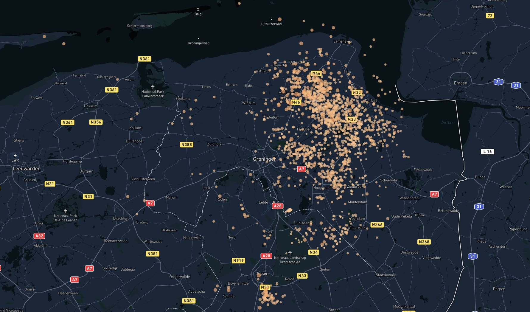
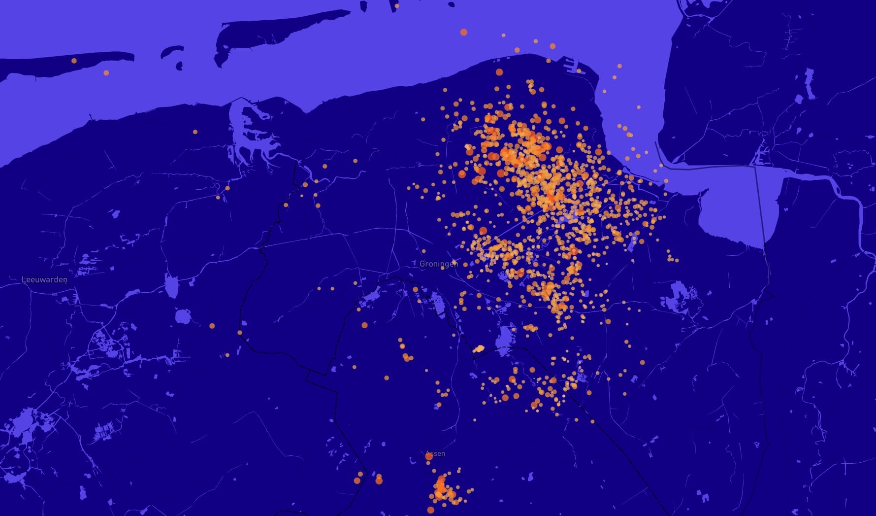
Earthquakes
In this example we show earthquakes in the nothern part of the Netherlands. When zoomed out we don’t need all the place or road labels, because we just want to focus on the impact that earthquakes can have on a certain area.
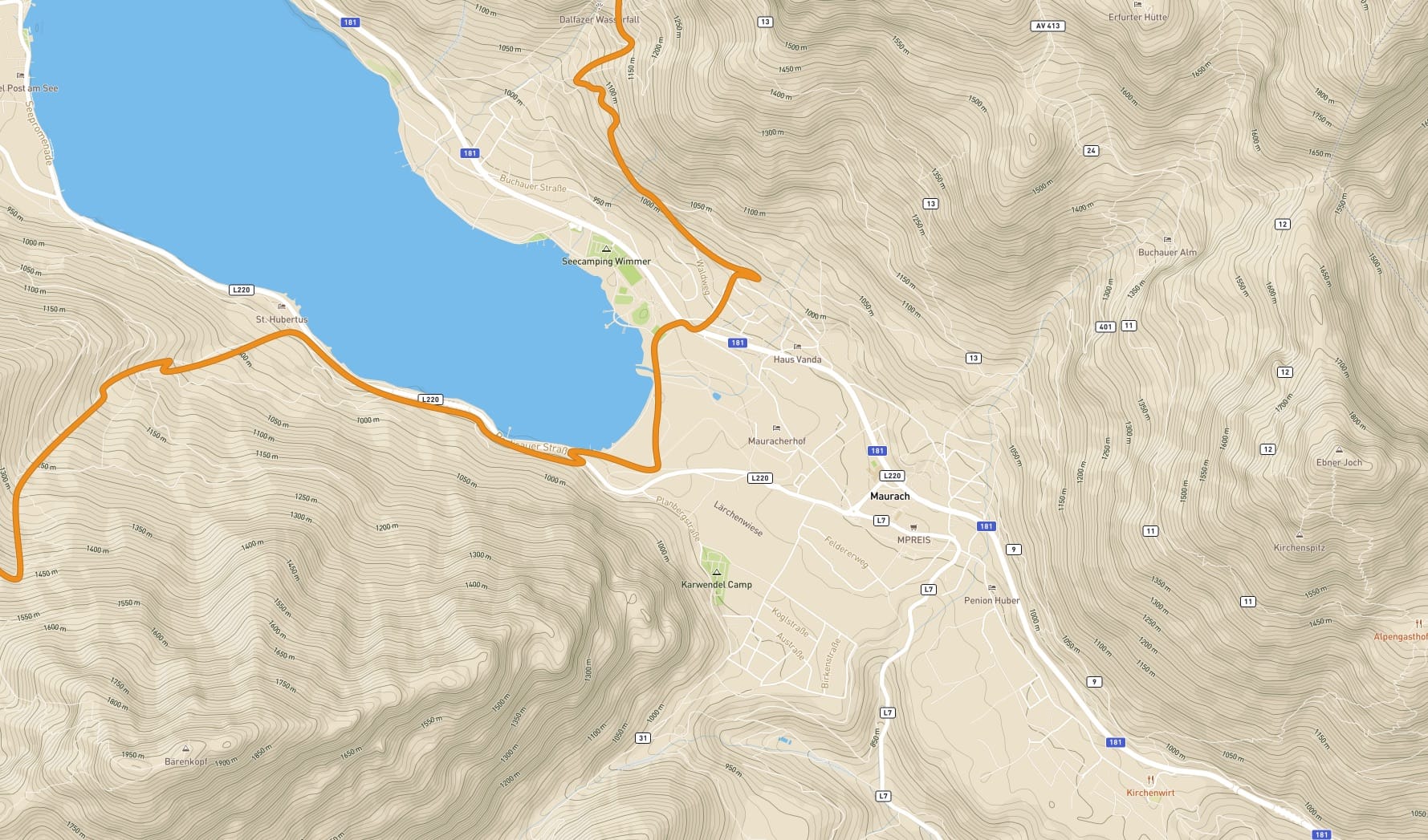
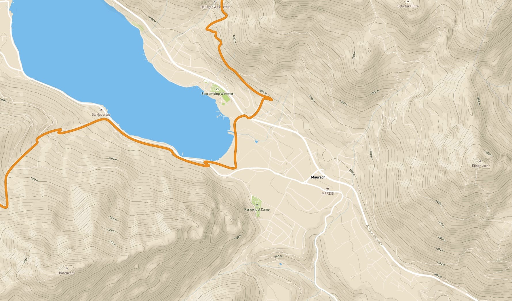
Hiking
The route itself, heights and some roads as en escape route are important. Most other elements are less important.
How to improve?
In the above examples you can see the difference between a lot of detail on the map versus less detail on the map. There are a few steps you can take to improve this.
- Set your goal - As a hiker I want to walk my route and see beautiful places on the route. I have no use for house numbers or football clubs. So put yourself in the shoes of the people who use your map and see what really matters. What do you want to mean for the user with your map? It often works well to discuss this with a few people to gain new insights.
- Start with an empty basemap - In tools such as ArcGis and Mapbox you can start an empty basemap. You then build this up with the layers you need. You start with land and water Continue with roads, buildings, labels, etc. Because you start with nothing, you immediately make choices about which layers really matter. This works better than starting with a full map and then leaving out layers.
- Adjust your basemap layers - If highways get a lot of attention in your basemap, then that is of little use to you as a hiker. By making these less prominent you can help the hiker to focus more on the route.
- Focus on an area - Suppose you show demographic data in the Netherlands, then hide all other countries from your map. Other countries are of no use unless you do something with them.
- Try and Test - Reduce the noise of your map and test it with users if you can. Collect feedback and make adjustments where necessary. Try to start simple because once you start extensively it will be harder to go back.
Wrap up
Showing less on a map means more efficiency for the map user. If you are not distracted on the map by things that don’t matter, you can reach your goal faster. Everyone has a different taste, but many like me think that less design is often more beautiful aswell. ;-)